Toggle navigation
Search
Search
Inloggen / Aanmelden
Inloggen
New Account / View Pricing
Verken
360° Video Gallery
Wereldkaart
Editor's Picks
Gigapixels
360° Stereoscopic Panoramas
Learn
CONTRIBUTE
LICENSE
EARN $ FROM YOUR WORK
FREE RESEARCH
Verken
360° Video Gallery
Gigapixel Gallery
Curated Sets
Wereldkaart
360° Stereoscopic
Keuze van de redactie
More
Learn
CONTRIBUTE
LICENSE
EARN $ FROM YOUR WORK
FREE RESEARCH
Aanmelden/Inloggen
Inloggen
Get a new Contributor Account
Get a new Licensing Customer Account
Newsletter
×
Lightboxes
Copy
Create New Lightbox
This Lightbox is empty
×
Saved!
Search Results for @tags mountain loop highway
Keywords
Location
Contributor
Show only licensable content
Show live previews
Search
Keyword Tip: Use quotation marks ("Golden Gate Bridge") to search for an exact phrase.
More tips
.
Panorama's (+10000)
Videos (1285)
Contributors (3)
William L
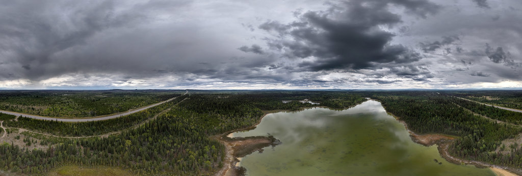
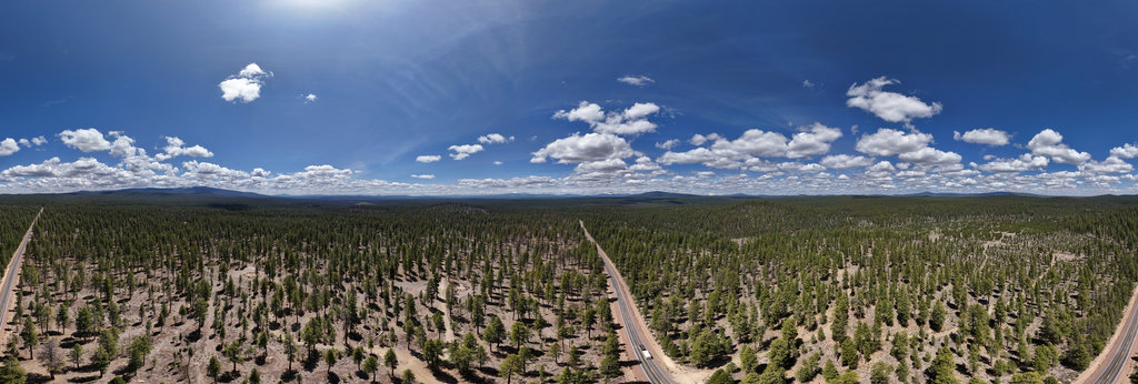
Highway 97 - Alkali Lake (aerial)
18800 x 9400
Auggie Werner
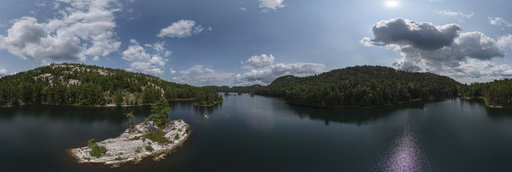
Islands on Grace Lake, Killarney, Ontario
17948 x 8974
Auggie Werner
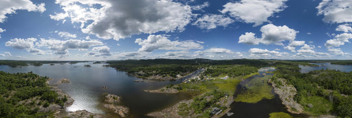
The North Channel near Whitefish Falls, Ontario
18016 x 9008
Jindrich Cermak
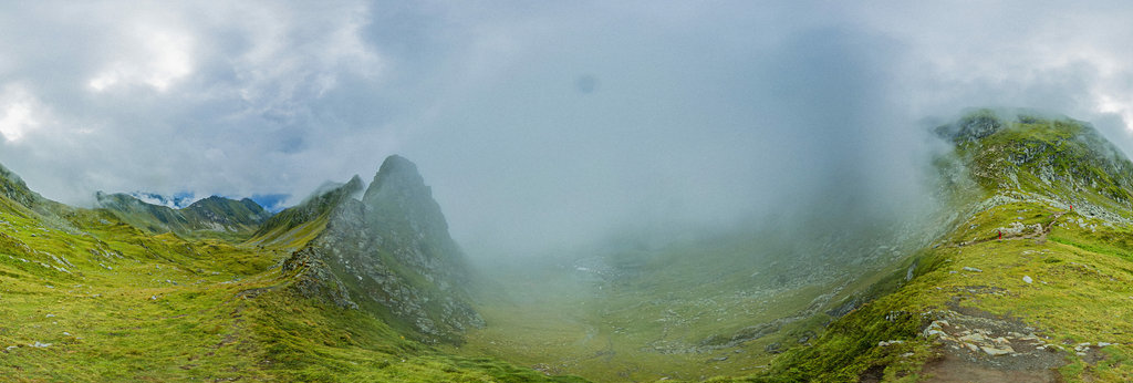
Curmătura Bâlei above the Transfăgărășan Pass in Romania (2170 m)
11904 x 5952
Wayne Drzewiecki
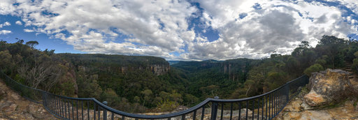
Warris chair lookout valley views, Budderoo National Park, New South Wales, Australia
24650 x 12325
William L
Silver Lake Road (aerial)
18800 x 9400
Herbert Raab
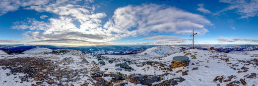
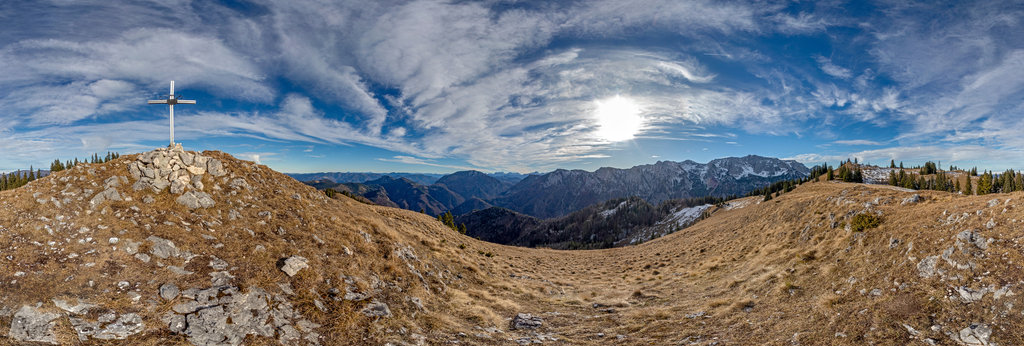
Gertrusk (2044 m)
17706 x 8853
Herbert Raab
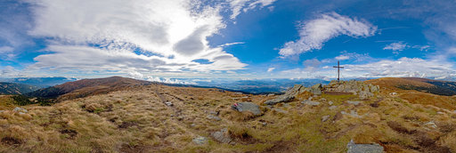
Zirbitzkogel (2396 m)
17154 x 8577
Herbert Raab
Haderlauskögerl (1547 m)
17620 x 8810
William L
Big Four Ice Caves (exterior) [2]
13200 x 6600
William L
Teslin (aerial)
18800 x 9400
William L
McClure Pass (aerial)
18800 x 9400
Joo Yeong-bae
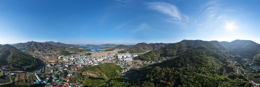
the mountain in front of Seongnae Village - 성내마을 앞산 (KTX 종착역)
20000 x 10000
Joo Yeong-bae
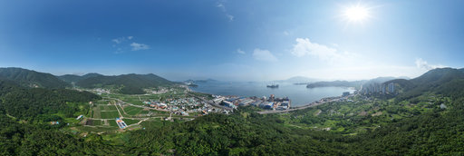
the mountain near Jung-ri Village, Hacheong - 하청 중리마을 인근 산
20000 x 10000
William L
Highway 97/A12 intersection (aerial)
18800 x 9400
William L
Highway 395/270 junction (aerial)
18800 x 9400
William L
Highway 88 - Devils Garden (aerial)
18800 x 9400
William L
Dempster Highway - thawing permafrost (aerial)
18800 x 9400
William L
Klondike Highway - Twin Lakes (aerial)
18800 x 9400
William L
Highway 37 - Revision Creek (aerial)
18800 x 9400
William L
Dempster Highway - Mackenzie River (aerial)
18800 x 9400
William L
Cassiar Highway - Dease Lake (aerial)
18800 x 9400
William L
Highway 12/Brim Road (aerial)
18800 x 9400
William L
Klondike Highway - Gravel Lake (aerial)
18800 x 9400
← Previous
-
1
-
2
-
…
-
9
-
10
-
11
-
12
-
13
-
14
-
15
-
16
-
17
-
…
-
416
-
417
-
Next →
Cookies help us deliver great service to you. By using this site, you agree to the use of cookies.
OK
Leave this Site