Toggle navigation
Search
Search
Inloggen / Aanmelden
Inloggen
New Account / View Pricing
Verken
360° Video Gallery
Wereldkaart
Editor's Picks
Gigapixels
360° Stereoscopic Panoramas
Learn
CONTRIBUTE
LICENSE
EARN $ FROM YOUR WORK
FREE RESEARCH
Verken
360° Video Gallery
Gigapixel Gallery
Curated Sets
Wereldkaart
360° Stereoscopic
Keuze van de redactie
More
Learn
CONTRIBUTE
LICENSE
EARN $ FROM YOUR WORK
FREE RESEARCH
Aanmelden/Inloggen
Inloggen
Get a new Contributor Account
Get a new Licensing Customer Account
Newsletter
×
Lightboxes
Copy
Create New Lightbox
This Lightbox is empty
×
Saved!
Search Results for @tags engineer creek
Keywords
Location
Contributor
Show only licensable content
Show live previews
Search
Keyword Tip: Use quotation marks ("Golden Gate Bridge") to search for an exact phrase.
More tips
.
Panorama's (4141)
Videos (388)
Contributors (1)
Robert Prior
Chapman Creek, Sunshine Coast, British Columbia (VI)
20000 x 10000
Robert Prior
Chapman Creek, Sunshine Coast, British Columbia (VII)
20000 x 10000
Robert Prior
Chapman Creek, Sunshine Coast, British Columbia (VIII)
20000 x 10000
Robert Prior
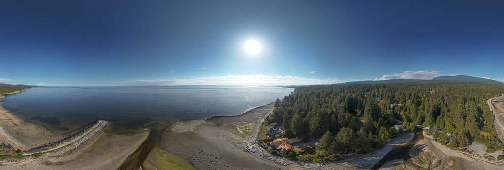
Aerial view of the mouth of Chapman Creek at Davis Bay (Arran LUT)
18000 x 9000
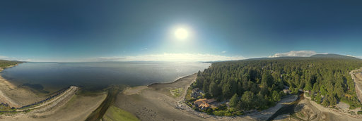
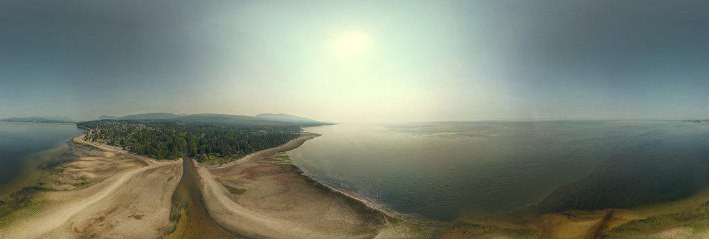
Robert Prior
Aerial view of the mouth of Chapman Creek at Davis Bay
18000 x 9000
Robert Prior
Late Afternoon Over Roberts Creek Arran LUT)
18000 x 9000
Robert Prior
Late Afternoon Over Roberts Creek (Bleach Bypass)
18000 x 9000
Robert Prior
Late Afternoon Over Roberts Creek (Mull LUT)
18000 x 9000
Robert Prior
Late Afternoon Over Roberts Creek (Braemar LUT)
18000 x 9000
Robert Prior
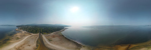
Aerial view of the mouth of Chapman Creek at Davis Bay (Bleach Bypass)
18000 x 9000
Robert Prior
Aerial view of the mouth of Chapman Creek at Davis Bay (Braemar LUT)
18000 x 9000
Robert Prior
Aerial view of the mouth of Chapman Creek at Davis Bay (Mull LUT)
18000 x 9000
Auggie Werner
Cloudy Winter Sunset at Lynde Shores Conservation area, Whitby, ON
17860 x 8930
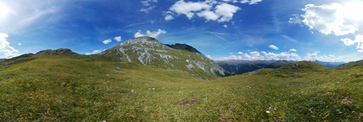
Isabel Marques
On the way to the Schiahorn 2
6000 x 3000
William L
Highway 395 - Vance Creek corner (aerial)
18800 x 9400
Ken Stahley
Middle Fork Of Fifteen Mile Creek
16000 x 8000
Ken Stahley
Belt Creek Canyon Opens To Meadows
16000 x 8000
Ken Stahley
Birch Creek / Two Medicine River Confluence
16000 x 8000
Bill Landenberger
Under Wallis Creek Railway Bridge 1
20650 x 10325
Bill Landenberger
Under Wallis Creek Railway Bridge 2
20666 x 10333
Robert Prior
Wilson Creek, British Columbia (Arran LUT)
18000 x 9000
Bill Landenberger
Blue Gum Creek falls and cave
27516 x 13758
Bill Landenberger
Blue Gum Creek falls from above
27420 x 13710
Bill Landenberger
Blue Gum Creek falls from below
27414 x 13707
← Previous
-
1
-
2
-
…
-
17
-
18
-
19
-
20
-
21
-
22
-
23
-
24
-
25
-
…
-
164
-
165
-
Next →
Cookies help us deliver great service to you. By using this site, you agree to the use of cookies.
OK
Leave this Site