Toggle navigation
Search
Search
Se connecter / S'inscrire
Se connecter
New Account / View Pricing
Explorer
360° Video Gallery
Carte du monde
Coups de Coeur
Gigapixels
360° Stereoscopic Panoramas
Learn
CONTRIBUTE
LICENSE
EARN $ FROM YOUR WORK
FREE RESEARCH
Explorer
360° Video Gallery
Gigapixel Gallery
Curated Sets
Carte du monde
360° Stereoscopic
Coups de coeur
More
Learn
CONTRIBUTE
LICENSE
EARN $ FROM YOUR WORK
FREE RESEARCH
S'inscrire/Se connecter
Se connecter
Get a new Contributor Account
Get a new Licensing Customer Account
Newsletter
×
Lightboxes
Copy
Create New Lightbox
This Lightbox is empty
×
Saved!
Search Results for @tags aerial mining
Keywords
Location
Contributor
Show only licensable content
Show live previews
Search
Keyword Tip: Use quotation marks ("Golden Gate Bridge") to search for an exact phrase.
More tips
.
Panoramas (+10000)
Videos (1175)
Contributors (8)
William L
Long Dong Silver (aerial)[2]
18800 x 9400
William L
Long Dong Silver (aerial)[3]
18800 x 9400
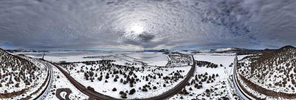
William L
Interstate 70 - Dillon Reservoir (aerial)
18800 x 9400
William L
Interstate 5 - Louie Road (aerial)
18800 x 9400
William L
Tarn below Perkins Peak (aerial)
18800 x 9400
William L
Atnarko/Talchako River confluence (aerial)
18800 x 9400
William L
M. Gurr alpine lakes (aerial)
18800 x 9400
William L
Highway 97 - Salt Lake (aerial)
18800 x 9400
William L
Highway 20 - Klinaklini River (aerial)
18800 x 9400
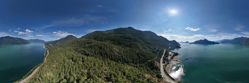
William L
Howe Sound - Porteau Cove (aerial)
18800 x 9400
William L
Highway 20 - Lees Corner (aerial)
18800 x 9400
William L
Lady in the Bathtub (aerial)
18800 x 9400
William L
Rooster/Setting Hen Buttes (aerial)
18800 x 9400
William L
Highway 50 - Woods Reservoir (aerial)
18800 x 9400
William L
Colusa Highway rice fields (aerial)
18800 x 9400
William L
Jot Dean Ice Cave (aerial)
18800 x 9400
William L
Highway 351/Paradise Road (aerial)
18800 x 9400
William L
Francis Landrum Historic Wayside (aerial)
18800 x 9400
William L
Rogue River - Riverside Park (aerial)
18800 x 9400
William L
Tater Hill rockslide (aerial)[1]
18800 x 9400
William L
Tater Hill rockslide (aerial)[2]
18800 x 9400
William L
Deadman Mountain north cliffs (aerial)
18800 x 9400
William L
Tres Santos Fire Pond (aerial)
18800 x 9400
William L
Richard G. Baker Park (aerial)
18800 x 9400
← Previous
-
1
-
2
-
…
-
76
-
77
-
78
-
79
-
80
-
81
-
82
-
83
-
84
-
…
-
416
-
417
-
Next →
Cookies help us deliver great service to you. By using this site, you agree to the use of cookies.
OK
Leave this Site